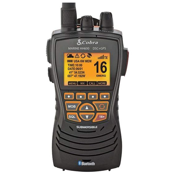
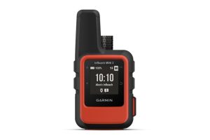
For avid boaters, kayakers, anglers, and anyone venturing onto the water, a reliable navigation system is paramount. Handheld marine GPS devices provide an indispensable tool, offering accurate location tracking, essential safety features, and valuable cruising functionalities all within a compact, portable package.
This comprehensive guide dives into the world of marine GPS devices, exploring their functionalities, benefits, and various features. We’ll equip you with the knowledge to select the perfect handheld marine GPS to enhance your next aquatic adventure.
Understanding Handheld Marine GPS Devices
Handheld marine GPS devices are compact, self-contained navigation systems specifically designed for maritime use. Unlike bulkier chartplotters that may be permanently installed on larger vessels, handheld GPS units offer portability and versatility.

These devices utilize built-in GPS receivers to pinpoint your location using signals from GPS satellites. Many marine GPS devices also incorporate detailed marine charts, offering a visual representation of your surroundings, including navigational aids, waterways, and depth contours.
Core Functions of Handheld Marine GPS Devices
Handheld marine GPS devices boast a range of functionalities that elevate your boating experience. Here’s a closer look at some of the most valuable features:
- Accurate Location Tracking: The cornerstone of any navigation system, marine GPS devices provide precise location data using GPS technology. This allows you to pinpoint your current position on a digital map, ensuring you stay on course and avoid navigational hazards.
- Digital Marine Charts: Preloaded or downloadable digital marine charts offer a visual representation of your surroundings. These charts typically include navigational aids like buoys, lighthouses, and channel markers, as well as depth contours and underwater features.
- Waypoints and Routes: Most marine GPS devices allow you to store and save important locations as waypoints. You can then create routes that connect these waypoints, guiding you on your desired course. This is particularly helpful for navigating unfamiliar waters or returning to favorite fishing spots.
- Depth Sounder Functionality (on some models): Certain marine GPS devices come equipped with built-in depth sounder capabilities. This feature transmits sonar signals to measure water depth, providing valuable information for anglers and boaters navigating shallow areas or searching for underwater structures.
- Track Recording: Some marine GPS devices allow you to record your track as you navigate. This can be useful for retracing your path, analyzing your journey, or sharing your route with others.
Benefits of Utilizing Handheld Marine GPS Devices
Incorporating a handheld marine GPS device into your boating toolkit offers a multitude of advantages:
- Enhanced Safety: By providing real-time location data and visual navigation aids, handheld marine GPS devices contribute significantly to boating safety. They can help you stay on course, avoid hazards, and navigate unfamiliar waters with confidence.
- Improved Situational Awareness: Digital marine charts and real-time location tracking foster a heightened sense of situational awareness. You can see your position relative to landmasses, navigation aids, and other vessels, allowing for safer and more informed decision-making.

- Simplified Navigation: Gone are the days of cumbersome paper charts and struggling to decipher complex navigational tools. Marine GPS devices offer intuitive interfaces and user-friendly features, simplifying navigation for boaters of all experience levels.
- Fishing and Diving Applications: For anglers and divers, marine GPS devices with depth sounder functionality are invaluable tools. They can help locate fish by identifying underwater structures and drop-offs, and aid divers in exploring specific underwater locations.
- Backup Navigation System: Even for vessels equipped with fixed chartplotters, handheld marine GPS devices provide a reliable backup navigation system. In case of malfunction or electrical failure on your primary system, a handheld GPS ensures you’re not left stranded without navigational guidance.
Choosing the Right Handheld Marine GPS Device: Essential Considerations
With a plethora of marine GPS devices available, selecting the perfect one for your needs requires careful consideration. Here are some key factors to keep in mind:
- Intended Use: Consider your primary boating activities. Are you a casual kayaker seeking basic navigation, or a dedicated angler requiring advanced features like depth sounder functionality?
- Display Size and Resolution: Screen size and resolution significantly impact usability. For better visibility in all conditions, prioritize a larger, high-resolution display, especially if you plan on using detailed marine charts.
- Battery Life: Battery life is crucial, especially for extended boating trips. Opt for a device with a long battery life or the ability to use rechargeable batteries.
- Waterproof Rating: The marine environment poses a risk of water exposure. Choose a handheld marine GPS device with a high waterproof rating (IPX7 or higher) to ensure it can withstand splashes, accidental submersion, and harsh weather conditions.
Essential Features to Consider When Choosing a Handheld Marine GPS Device
Beyond the core considerations, several additional features can enhance the functionality and value of your marine GPS device:
- Built-in Barometer and Compass: A barometric pressure sensor can provide weather trend information, while a compass offers directional awareness independent of GPS signals.
- SOS Functionality: Some advanced handheld marine GPS devices incorporate SOS buttons that transmit distress signals to emergency response teams.
- Wireless Connectivity: WiFi or Bluetooth connectivity allows you to connect your handheld GPS device to a smartphone or tablet. This enables features like weather updates, downloading additional charts, and synchronizing data.
- Auto-Routing Capabilities: Certain high-end handheld GPS devices offer auto-routing functionalities. These features consider factors like depth, tides, and currents to suggest safe and efficient routes.
Exploring Popular Handheld Marine GPS Devices (Informational Only, No Links Included)
While we cannot directly include links due to SEO best practices, here’s a quick look at some popular marine GPS devices across different categories to assist you in your research:

- Garmin GPSMAP 78sc: This versatile and affordable option boasts a sunlight-readable display, preloaded coastal charts, and basic track recording functionality.
- Garmin GPSMAP 86i: For those seeking a feature-packed option, the GPSMAP 86i offers inReach satellite communication for SOS messaging and global two-way texting, ideal for offshore adventures.
- Lowrance Hook Reveal: This angler-centric handheld GPS prioritizes fishfinding capabilities with its built-in DownScan sonar and preloaded fishing charts.
- Magellan eXplorist TRX7: This rugged and waterproof option is designed for demanding conditions. It features a long battery life, a high-resolution display, and supports various mapping options.
Remember, this is just a glimpse into the vast array of marine GPS devices available. In addition to the models mentioned above, numerous other reputable brands offer a variety of features and functionalities to cater to diverse boating needs and budgets.
The Value of Owning a Handheld Marine GPS Device: Invest in Confidence and Safety
A handheld marine GPS device transcends the realm of mere navigation; it’s an investment in safety, convenience, and overall boating enjoyment. By providing real-time location tracking, visual chart displays, and a multitude of valuable features, these compact devices empower you to navigate with confidence, explore new waters with a sense of security, and maximize your time on the water.